GeoNdxR: Water Reuse Index and Beyond
 Communities around the United States are thinking of alternative water systems to address local water challenges. One example of this is water reuse, which is defined by the Environmental Protection Agency (EPA) as “the practice of reclaiming water from a variety of sources, treating it, and reusing it for beneficial purposes.” The current social problem is that communities only see water reuse as an opportunity for areas that are experiencing water scarcity, rather than realizing it’s full potential to address a wide range of water challenges, like lowering flood risk, reducing combined sewer overflows, and minimizing the nutrients that are discharged to the environment.
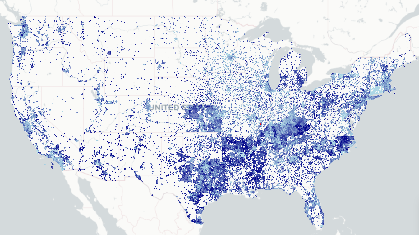
Our project aims to address this social problem by developing a framework for quantifying a community’s potential for water reuse based on various motivators—or drivers—to identify whether water reuse could be a local solution that merits further investigation. Using publicly available data across the US, our project looks at the correlation between drivers (both presence and intensity) and characterizes the benefits communities might find by exploring water reuse. Combining complex data into an informative index and displaying the results in a clear, digestible format will help assess water challenges and needs across the country, as well as support local decision-making.
Beyond the scope of water reuse specifically, we also allow index-creators across discplines to seamlessly create their own indices and web pages using the same generalized functions that we wrote and used in our process. You can think of our Interactive Water Reuse Website as a case study of an end-to-end index and website creation tool. The outputs of the project are an interactive web tool that allows users to map the severity of water reuse drivers across the United States, a geospatial data processing and conversion pipeline in the R programming language, and a general website creation (html file) template and functions.